Planisphere-StarMap
the Last Archive(version 6h, January-22nd 2011)(LZH,4025kB) / (zip,4087kB)
README for hayami.exe in English
README for strdrt.exe, a program to output a text file of Azimuths and elevations of stars
README for planet-files
REMARK: The format of planet-files change. If you use old version, the program stop. Please change to "prm***2.plt".
Data for Earth map(LZH,1862kB) / (zip,1822kB) / README(Feb 10th,2010)
Data for Cities[provisional, added with some cities of Nigeria, Syria and Jordan](Mar-6th,2010)
Nations list [in Japanese with SHIFT-JIS]
Nations list [in English within 7bit ASCII](Jan-08,2010)
Nations list [in Italian with ISO 8859-1](Jan-08,2010)
Nations list [in Dutch with ISO 8859-1](Jan-08,2010)
Nations list [in Germany with ISO 8859-1](Jan-08,2010)
Nations list [in French with ISO 8859-1](Jan-08,2010)
Not complete, but use for test.
January 22nd,2011:I have adjusted some functions for a Meteor Showers file, but I did not attach a Meteor Shower file.
July 24th,2009:Centralizing to Sun, Moon or a planet. Scale of Rectangular Coordinate. Setting the factor of "Shadow of Earth".
July 05th,2009:Sun, Moon and planets are added to obejcts for click-search.
Radius of planet are displayed in its Location data.
Aberrations of Object defined by Orbit elements are calculated.
June 17th,2009:Reinforcing "Moon line" in Hayami.exe.
June 12th,2009:writing comments around the clicked point (on hayami.exe), "The shadow of Earth" (on strdrt.exe).
June 5th,2009:adding strdrt.exe.
May 15th,2009:the parameter file for Saturn, increasing numbers of figures for longitudes and latitudes of "Location of Sight" and "Star by the Locaton",
increasing items saved as ".str", Adjusting the layout of the main window.
April 24th,2009:The intercafe of the main window chage. The format of planet-files change. The external file for nutation.
March 20th.2009:fixing a bug and preparing English documents
March 14th.2009:added calculation of proper motions, external file for precession,etc.
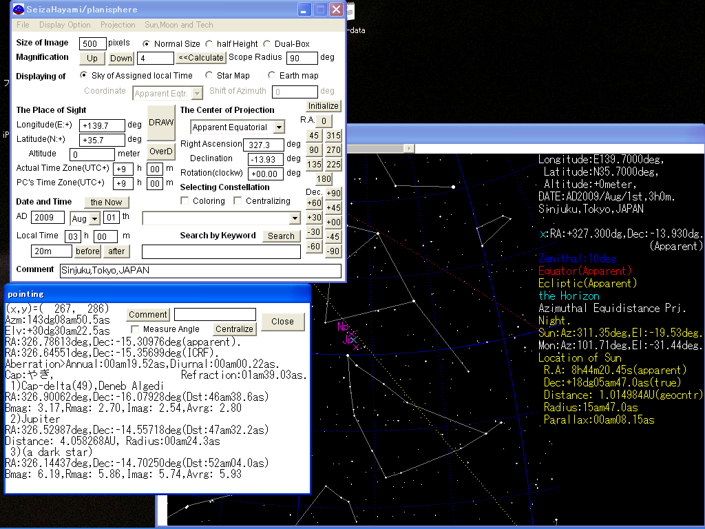
A Planisphere and StarMap with multi-projection.
This is made for an Eye-Obsevation or a Shooting by a cheap camera.
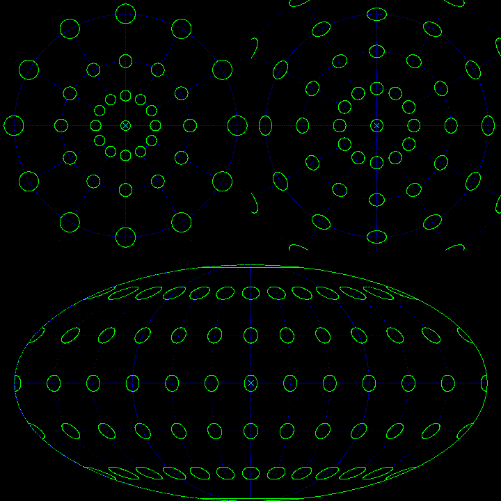
(1)Projection: 5 Azimuthal, 5 Cylindrical, 2 Pseud-Cylindrical, Hammer, Aitoff
(2)the All Celestial Grobe can be displayed by dividing to 2.
(3)...I can not remember All function because too many.
Samples
These are Samples, so I make these small, but you can make 5000pix*5000pix, or more.
But So large image is difficult to see :-)
as Usual Planisphere(Azimuthal Equidistant Projection)
Mercator Projection, that the Standard line is the Horizon
Transverse Mercator, from the South latitude 45deg, the Standard line is nearly Milky Way.
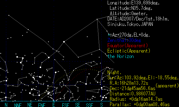
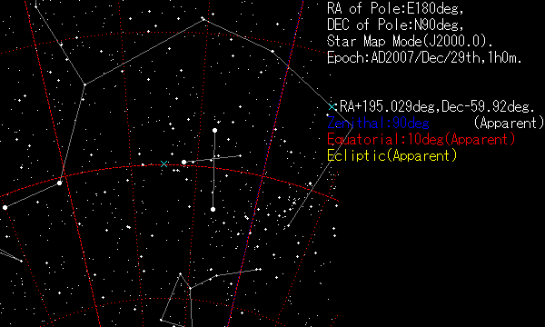
Around Southern Cross and Alpha and Beta Cen., as Star Map
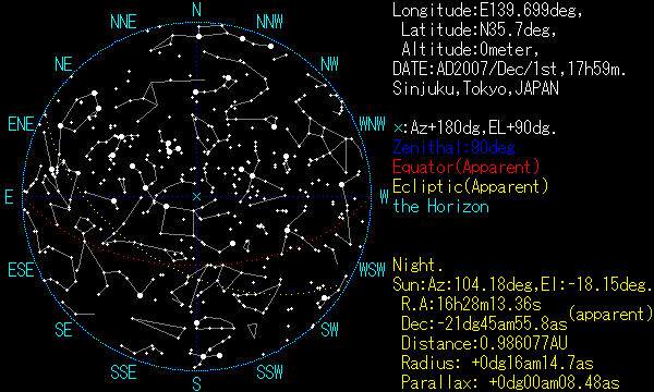
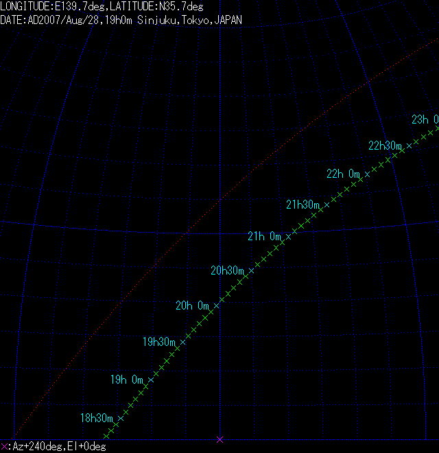
The Moon rising, from Shinjuku Tokyo, Aug-28th.2007(in Zenithal Coordinate)
The Red line is the Celestial Equator, But it departs slightly from just East on the Horizon, because of Refraction.
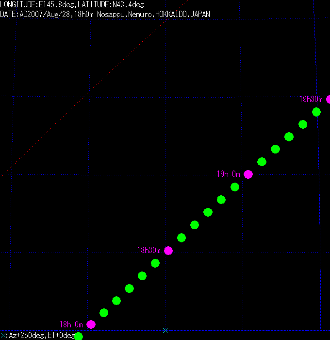
The Moon rising, from Nosappu Hokkaidou, Aug-28th,2007(in Zenithal Coordinate, true scale of Moon size)
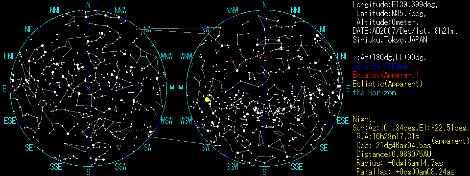
Dual Box mode. the right Circle is "Under the Horizon" or "from the Antipode".
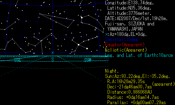
From the peak of Fuji, to South side, with drawing longitude- and latitude-line on the Earth.
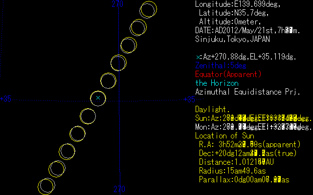
the Eclipse at May-21st.2012. the Yellow is Sun and the White is Moon (From Shinjuku,7h20m(the lowest)-7h50m(highest), interval of 3minutes)
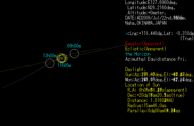
the Eclipse at July-22nd.2009 (from Naha), drawn on the equatorial coordinate system.
The white and blue line is "Moon line" (with the parallax from Naha).
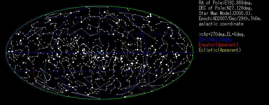
Mollweide Projection, with Galactic Coordinate.
Screen Shot.
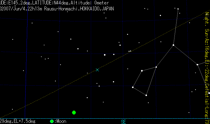
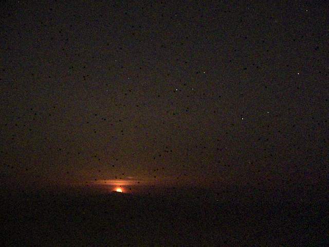
Compare the Sky Shot and Planisphere(From Rausu-Honmachi to Kunashiri-Island, June 4th 2007,22h13m local time)
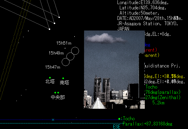
comparing a photo taken from JR-Asagaya station to Tokyo prefecture building at May 28th, 15h48m52s[time stamp by the camera]
and a simulation with the same condition.
Example for Skewness of Projections: Stereographic, Azimuthal Equidistant, and Mollweide projection.
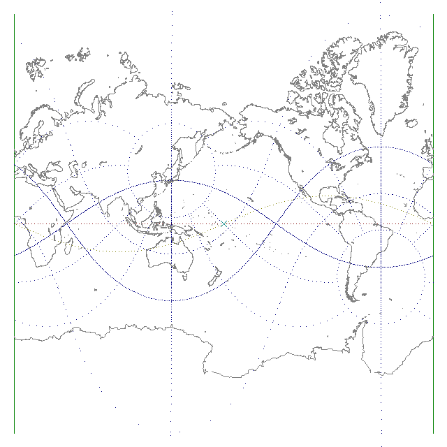
The Coast line, with usual Mercator Projection.
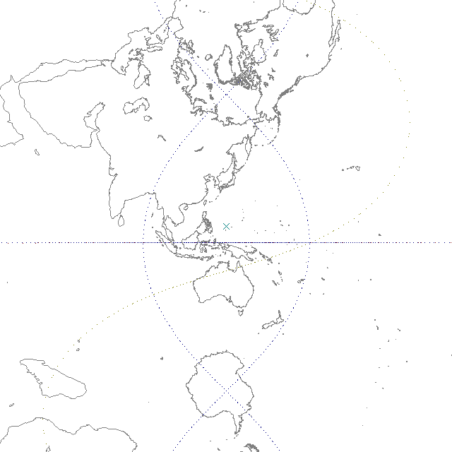
The Coast line with transverse Mercator Projection. the Standard line is East-Longitude 135deg.
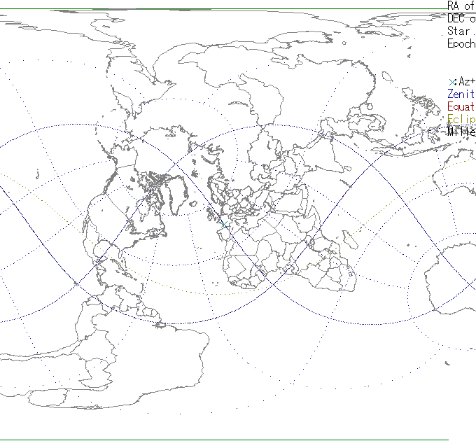
The Coast and Border line with Miller Projection. the Standard line is the great Circle I define throwaway :-)